Meridata MDCS software and systems
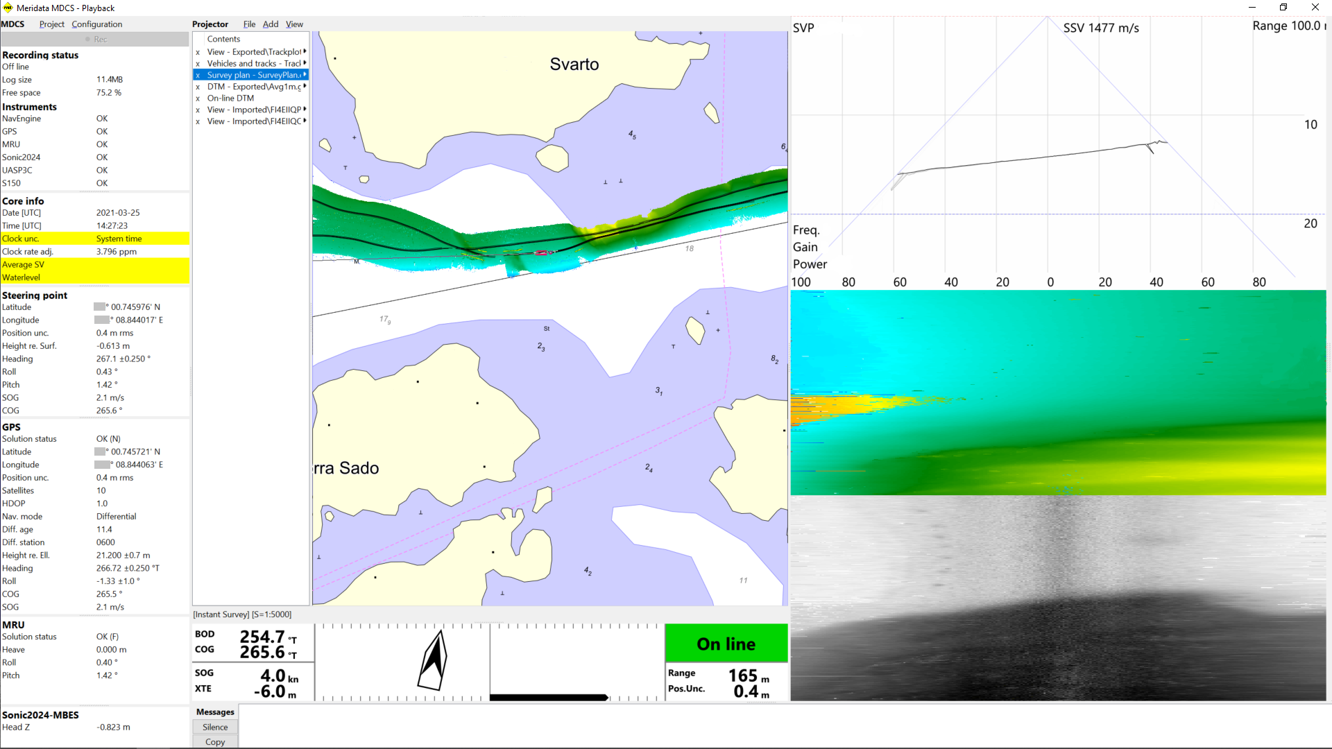
MDCS is a powerful package for survey planning, real-time mission
support and data acquisition. It is specifically designed for bathymetric
and marine geophysical surveys.
MDCS can interface with a wide variety of survey equipment and
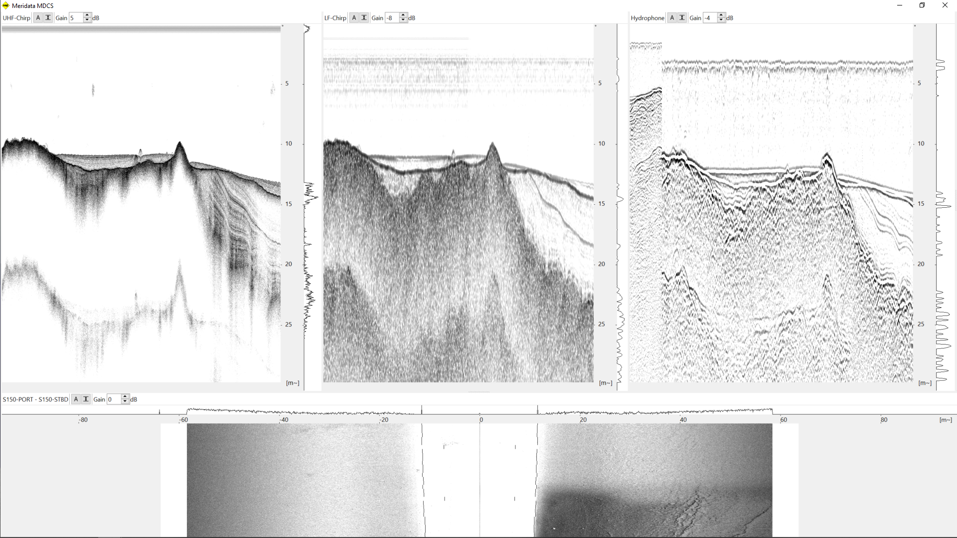
sensors, and supports concurrent acquisition of
- bathymetry,
- marine seismic,
- sub-bottom profiling and
- side-scan sonar data.
Meridata MDCS is designed with absolutely best accuracy, precision and
reliability in mind while offering superior user experience.
MDCS description
MDCS easily scales up from single instrument surveys to multi-mode,
multi-frequency surveys. There are no separate versions of MDCS for
different tasks, but instead, its modular design allows configuring
the system to precisely match your need. You can make a survey with
just one computer, running a single instance of MDCS and using just
one set of navigation instruments, but still work with many acoustic
instruments at once.
In the long run it also becomes evident that using MDCS reduces need for
operator training as all these surveys can be done with just this one
software package.
As an example of its reliability measures, Meridata MDCS supports redundant
positioning/heading/attitude sources to ensure continuous productivity. Another
one is the built-in support for sensor data quality control and monitoring.
Survey planning
MDCS contains graphical tools for survey plan management
(i.e., background chart information, definition of survey
areas and survey lines).
Survey data acquisition
The survey software also allows management of environmental data
(tide, sound velocities), as well as acquisition and
logging of the observations from external systems such as:
- sub-bottom profilers
- seismic reflection profiling systems
- side-scan sonars
- marine magnetometers
- bathymetric echo sounders
- positioning systems
- motion, attitude and heading reference systems
MDCS is being used around the world with a wide variety of
survey equipment configurations, and additional instruments
interface easily with the system.
Real-time survey support
MDCS provides support for vessel steering and survey
quality control. Acquired data streams are monitored for
acceptable quality figures and continuity. Any deviation
will be reported to the surveyor.
Through MDCS, the surveyor is also provided with unique
capabilities to control and monitor the sonar system.
Depending on the type of the survey, different real-time
presentations of the sonar data are available.
Data sets
MDCS logs data in proprietary Meridata MDCS raw data format.
This allows raw observations to be logged for each sensor in a way
that enables proper observation quality management prior to combining
them to final solutions.
The true power of MDCS data sets is easily seen when accessed with
Meridata MDPS processing and interpretation software.
There you can fine tune the processing settings of raw observations prior
to combination to final data records.
Similarly, this specific approach enables exporting the raw data from MDCS
to many industry standard data formats, such as SEG-Y and XTF, more
accurately than it would be possible when logging to these formats in real time.
Operating platform
MDCS real-time survey software currently runs on both stand-alone
and multiple networked PCs with Windows 10 and 11 operating systems.
Interested to know more?
Contact us for more info
Oy Meridata Finland Ltd
P.O. Box 18 (Veijolankatu 41) FIN-08151 LOHJA, FINLAND
Telephone +358 (0)19 321912
Copyright © 2024 Oy Meridata Finland Ltd. All rights reserved.


